Digitaler Untergrund
Workshop report „Digital Underground CH“ at ETH Zürich on September 6th, 2022

Continuing densification in cities also affects the underground. Developing digital twins and applying geoinformation technology will be essential for planning, developing, and managing the underground. This comes with a variety of significant challenges, such as assuring the availability of spatio-temporal data of sufficient quality, clearly defined and accessible interfaces, and reliable workflows, which include all stakeholders.
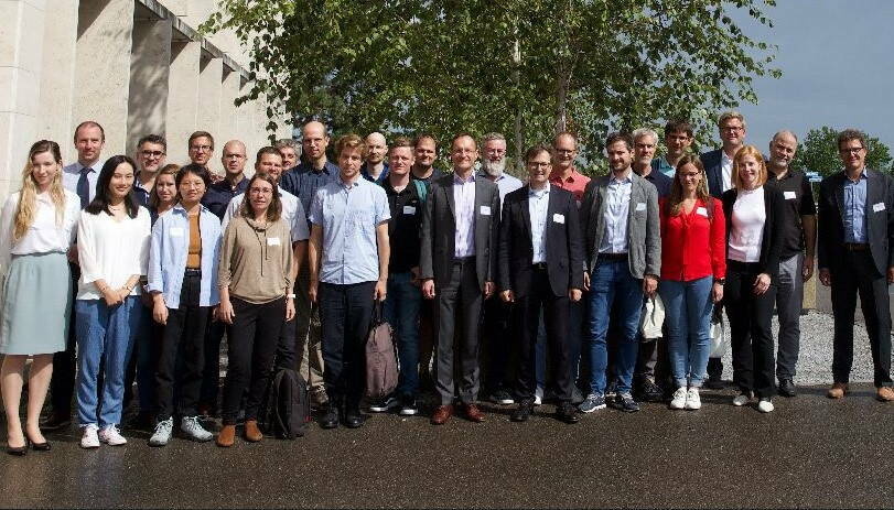
The one-day workshop “Digital Underground CH” took place at ETH Zürich on September 6th, 2022. It was organized by Prof. Martin Raubal and Prof. Andreas Wieser, and brought together experts, stakeholders and interested parties from Switzerland and abroad. The workshop aimed at identifying the needs and required actions for establishing the digital underground of Switzerland, as well as discussing the necessary frameworks and technological solutions.
The workshop started with a keynote presentation by Chris Chambers and Amy Manefield, who presented experiences from the already implemented and running National Underground Asset Register (NUAR) in the UK. Following, Rasmus Johansen demonstrated how 3D Reality Capture had been utilized for as-built subsurface utilities in Denmark.
In the second session, the participants were provided with overviews of Singapore’s Digital Underground experience (Martin Raubal), the Digital Twin of the City of Zurich and how it is applied to urban planning (Gerhard Schrotter), as well as necessary transformations of infrastructure documentation (Markus Schenardi).
The third presentation block focused on legal aspects, discussing open government data and utility cadastral systems (Christian Kaul), a demonstration of utilizing digital underground data as a resource for planning utilities in urban areas (Joram Schito), and innovative technologies for the underground from a company’s perspective (Risto Doncev). Overall, the presentations clearly documented that implementing a digital underground system is a multi-disciplinary endeavor, integrating technological, legal, business and human aspects.
The final part of the workshop consisted of group discussions, addressing the question ‘What will Switzerland need in terms of Digital Underground within the next 10 to 15 years, and how can we get there?’ Presentations by the group leaders confirmed the complexity of establishing Digital Underground Switzerland. It was deemed necessary to start with the identification of concrete use cases and problems to be solved with such system. One particular challenge will be the centralized definition of rules, considering the Swiss federalism. With this comes the question of who should be leading Digital Underground, an existing governmental entity, such as Swisstopo or ARE, or a newly established one? Further discussion points related to the integration of GIS and BIM, the integration of new data with legacy data, interoperability aspects, data security and questions regarding ownership of data. Finally, the presenters highlighted that awareness of the need of a Digital Underground system for Switzerland must be raised within politics to gain the necessary support.
The organizers thank all speakers and participants for their excellent contributions and SOGI for sponsoring this successful event.
SOGI GEOWebinar "Digitaler Untergrund" 2020
Antonia Cornaro currently works as an Expert and Business Development Manager for Amberg Engineering. She focuses on Urban Underground Space with the aim to increase mobility, livability and resilience of urban areas. This is also central to her work as Co-Chair of ITACUS, the International Tunnel and Underground Space Association's Committee on Underground Space. She is a part time lecturer at ETHZ with a lecture on the planning of underground space. Together with Han Admiraal she has recently published the book "Underground spaces unveiled: planning and creating the cities of the future". She claims that we need to plan the space in our cities more carefully than ever. A growing demand on housing, office space, infrastructure and open space is competing for the subsurface and urban surface areas. To gain better (Geo) insight a coordinated planning approach incorporating the subsurface is required. This requires a shift from thinking in area to thinking in volume.
Nils Oesterling ist zuständig für Datenmanagement der geologischen Grundlagendaten bei Swisstopo. Er ist Projektleiter von swissgeol.ch. Diese zweite Präsentation zeigt die vielfältigen Nutzungsmöglichkeiten des 3D-Viewer swissgeol.ch und verschiedenste geologische Daten. Geologische Daten spielen im täglichen Leben eine wichtige, wenn auch vielfach unbekannte, Rolle. Verschiedenste Branchen mit einem jährlichen Marktvolumen von mind. CHF 15 Mia. benötigen geologische Daten. Somit sind der Zugang und die einfache Nutzung dieser Daten durch Fachpersonen wichtig.
Matthias Vollmer arbeitet bei Geomatik + Vermessung Stadt Zürich und am Institut für Landschaftsarchitektur der ETH Zürich, sowie gründete das ETH-Spinoff SCANVISION. Der Titel seines Doktorats ist Zürich: Untergrund und Stadtlandschaft und das ist auch der Titel der nächsten Präsentation. Diese Forschungsarbeit zeigt den Untergrund der Stadt Zürich aus einer neuen Perspektive. Die Kommunikation über den Untergrund ist aktuell unbefriedigend, da die Daten heterogen, auf verschiedene Eigentümer verteilt, von den oberirdischen Daten getrennt und nur für die jeweiligen Fachleute fassbar sind. Anhand einer dreidimensionalen, auf Geodaten basierten Modellierung soll die Stadtlandschaft als ganzheitlicher Raum dargestellt und untersucht werden. Die Prämisse dieser Arbeit lautet: Die Weiterentwicklung des unterirdischen Raums auf visueller und begrifflicher Ebene verbessert die Zusammenarbeit der am Untergrund Beteiligten und trägt dazu bei, zukünftige Charakterisierungen unterirdischer Strukturen und Vorgänge zu entwickeln.
Bernd Domer est Professeur hes Genève et membre du comité Bâtir digital Suisse. Son enseignement et sa recherche se concentrent sur l’impact de la maquette numérique aux méthodes de travail, l’interopérabilité et la structuration de données générées ainsi que de la convergence des systèmes BIM/SIG. Stéphane Couderq, co-fondateur de Topomat, assure la direction de l’entreprise. Il bénéficie d’une expertise de plus de 25 années dans le domaine des systèmes d’information géographique. Ce projet est réalisé dans le cadre du programme InnoSuisse, en partenariat avec l’Hepia et l’Université de Genève; Topomat jouant le rôle de partenaire industriel. Ce projet comprend de nombreux aspects innovants, notamment dans l’élaboration d’une ontologie (modèle de données conceptuel), et d’une base de données de type triplestore, permettant l’usage de règles pour la complétude et l’analyse des données du sous-sol (réseau, géotechnique, végétation,…).
